|
|
|
|
Site Index:
In this Section:
|
UPDATE #26 10/05/06 thru 10/11/06 Howdy
Everybody,
We are very interested in hearing from ya’all.
If you have missed out on any of the previous emails and would like us
to re-send them, please let us know. Please
let me know if these emails containing pictures are too large and we will send
you a version with text only. The
period 4/1 thru 10/04 has been covered in Updates 1 through 25. UPDATE
#26 10/05/06 through
10/11/06.
As you may remember, we have been in St. Charles, Missouri since our
arrival on September 13, 2006. With
this email UPDATE, we continue our Loop trip and our great adventure along the
waterways. The visit with family was absolutely wonderful in everyway.
Now after 22 days, we are on our way.
10/05/06
THURSDAY ST.
CHARLES, MO to
KASKASKIA RIVER LOCK
After a restful night on the boat at Polestar Marina, mile 221.8 on the
Mississippi River, we were awakened very early by the alarm clock.
We organized and readied AMARSE to get underway.
It was still very dark as AMARSE and MISSY B eased out of the harbor
onto the Mighty Mississippi. Larry
and Doris Goby will be traveling with us to the Land Between the Lakes (LBL)
in Kentucky.
The weather was as forecasted at 59 degrees.
If the forecast holds, we should have enough good conditions to get us
down the Mississippi River, Ohio River, and up either the Tennessee River or
the Cumberland River to Green Turtle Bay in Grand Rivers, Kentucky.
We have allocated the next four days for the journey.
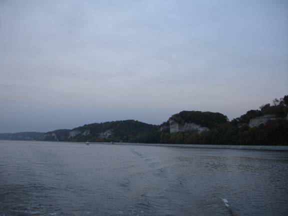
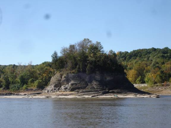
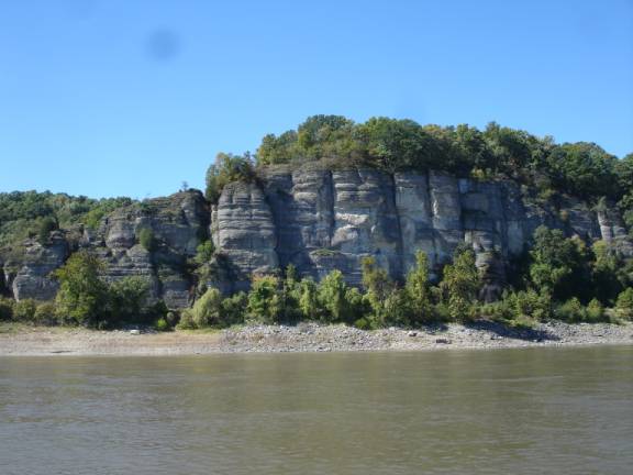
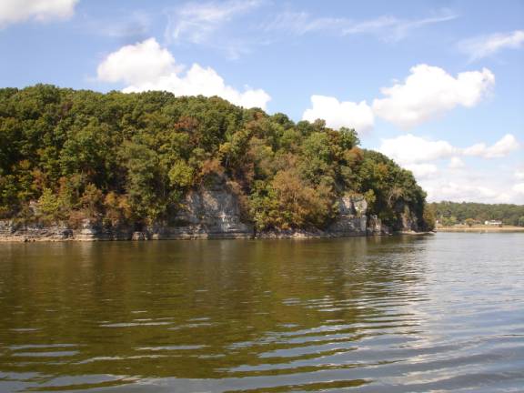
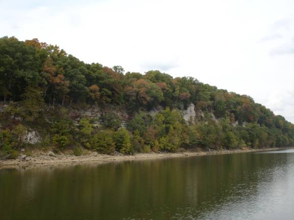
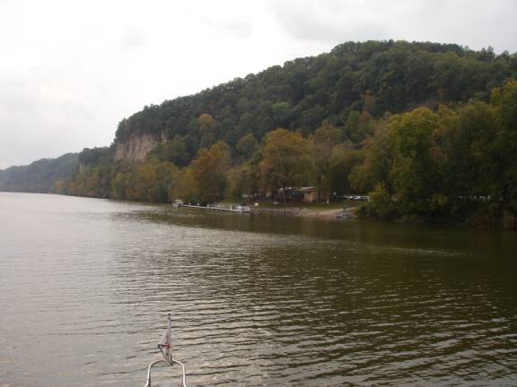
As we sip coffee at the helm, the breaking daylight gently illuminates
the limestone cliffs lining the eastern bank of the river.
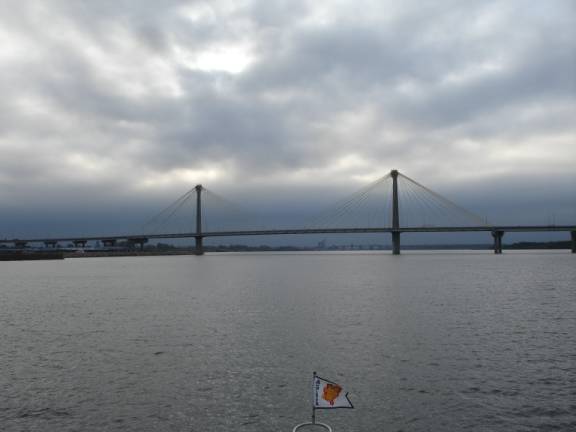
The new bridge at Alton, Illinois is of a unique design that is quite
beautiful.
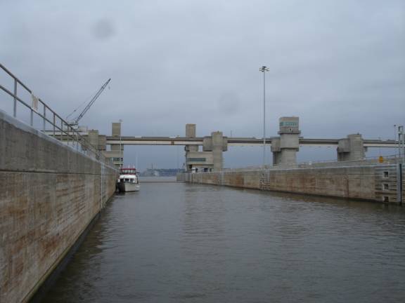
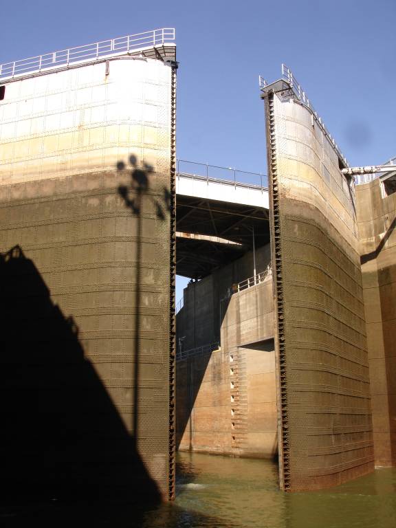
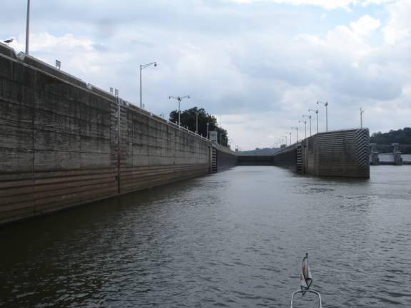
The
lockmaster at the Mel Price Lock #26 in Alton, Illinois, had the gates open
and the flashing green light welcomed us to enter the chamber that would lower
us to the next pool. Missy B was
nestled against the lock wall behind us at 8:45 am.
Do you think it was “Lucky Larry” that helped us get a quick
locking sequence?
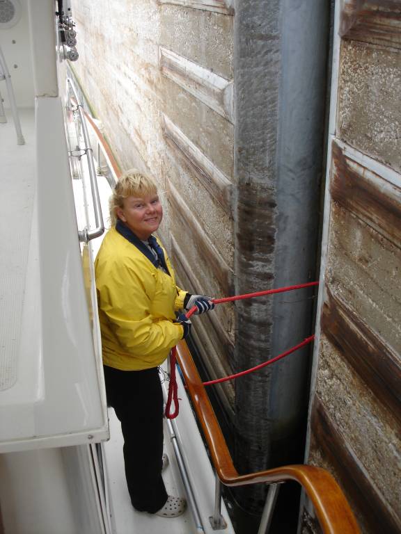
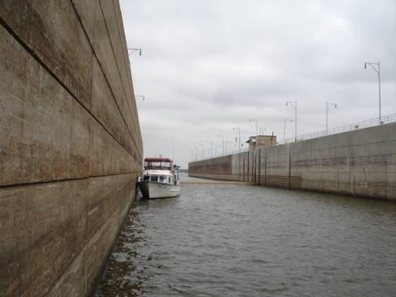
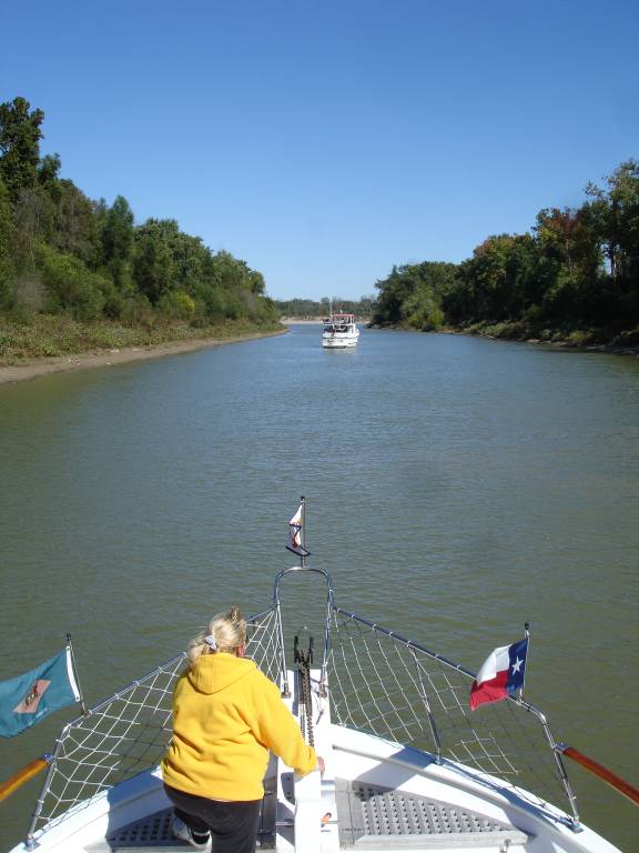
Judy is very skilled at line handling in the locks.
This was her first experience with a “floating bollard”.
These ingenious devices rise or fall with the changing water level.
We attach a line to our amidships cleat, then take two wraps
counterclockwise and cleat the line again.
This method secures the boat to the bollard while we gently fend off
the bow and stern off the wall.
In
less than 15 minutes, we were merrily on our way down the river again.
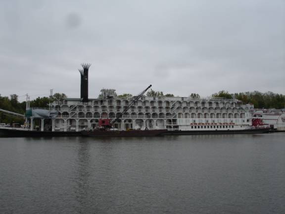
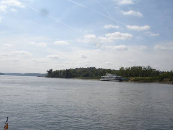
We were surprised to see the “American Dream” lying alongside the
riverbank. This sternwheeler is
in the same fleet as the “Delta Queen” and is a cruise ship type vessel
that plies the western rivers. She
is probably here for repairs. We
had seen her lying dormant in New Orleans in April.
At 9:25 am, we passed the confluence of the Mississippi and Missouri
Rivers. Since leaving this
morning, we now have the combined forces of these three powerful rivers,
including the Illinois River.
“Lucky Larry” was at it again.
We were greeted by a flashing green light at the Chain of Rocks Lock
#27. Without delay, we entered
the chamber to be lowered in the final lock on the Mississippi River.
From this point south for about 1000 miles, there are no more locks on
the “Ole’ Miss”. We,
however, will turn off the Mississippi River onto the Ohio River in another
185 miles. We will have plenty more locks along our routing.
The river cuts right down along St. Louis.
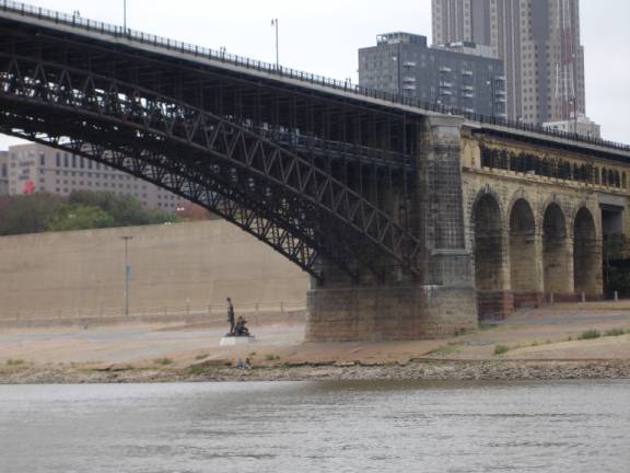
A number of bridges connect East St. Louis, Illinois with St. Louis,
Missouri. One of the early
bridges is the Eads Bridge. Notice the intricate architecture using steel and stone. You
will also see a statue commemorating this point on the Lewis and Clark
Expedition.
An interesting bit of history here.
While this bridge was being built, a large number of workers were
injured or lost their lives while doing underwater diving duty.
They suffered from condition then termed as “Caisson’s Disease”.
It was not understood then, but now we know of it as “nitrogen
narcosis”, or “decompression sickness”, or the “bends”.
When divers stay under too long, the blood absorbs too much nitrogen.
As they surface, the nitrogen “bubbles” out in the bloodstream
causing extreme damage and even death. Scientists
and divers now know that the downtime and surfacing rate must be timed and
limited to prevent these problems.
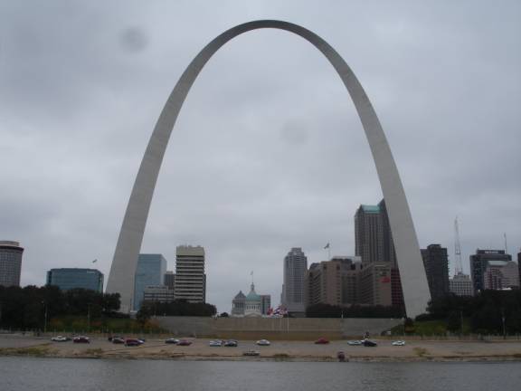
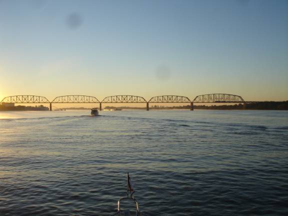
The Arch is a spectacularly memorable sight from the river.
The swift current is adding several miles per hour to our downriver
speed.
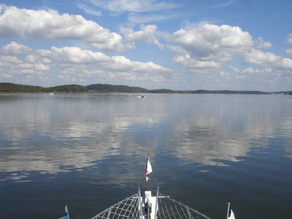
Look how peaceful and tranquil the river is on this lovely
afternoon. I bet you think it’s
all relaxation all the time.
Just before that tranquil picture was taken, Larry decided to spice up
everybody’s afternoon. We got a
radio call from Doris on “Missy B”. In
a somewhat stressed tone, she advised us that both of their engines had quit
and that they were floating down the river in the current without control.
Well, we quickly turned AMARSE around and headed for them.
Judy got the fenders down and rigged some tie lines.
We eased up alongside “Missy B” and tied up in raft style.
We could now move together using our engines to control both boats.
Larry was below working to restore power.
Within a half hour or so, Larry had both engines running again.
It seems that he had waited too long to switch fuel tanks.
In essence, both engines ran out of fuel.
He had to switch tanks and then “bleed” the air out of the fuel
system before they would start. Of
course, we accused Larry of doing it on purpose just to get some attention.
He denies it, but we’re not sure.
With everything back to normal, we resume our peaceful cruise down the
river.
We were going to stop at Hoppie’s Marina at mile 158.5.
It was only 1:05 pm and it seemed too early to stop on this lovely
traveling day. I suggested that
we keep on moving south and go to the lock wall at the Kaskaskia River lock. At 4:45 pm, we tied up to the lock wall under the direction
of a helpful and friendly lockmaster. This
is a good secure place to spend the night and the price is right. (free)
After cocktails aboard Missy B, Judy and I enjoyed a sumptuous dinner
that included a fresh, tossed salad. The
main course consisted of Spinach and cheese ravioli in a butter sauce with
Parmesan cheese. Very, very
tasty. POSITION:
N37 58.892 W089 56.631 Mile
117.3 10/06/06 FRIDAY KASKASKIA LOCK WALL TO LITTLE DIVERSION CHANNEL
HAPPY BIRTHDAY TO MY WONDERFUL DAUGHTER,
SHARYN CASSIDY. (Note:
October 6th was Fred’s Dad’s Birthday too.
We have always thought it was a great honor that Sharyn was born on the
same day. Hope you’re looking down with that great smile, Dad).
By 6:55 am, we had enough light to safely depart the lock wall.
We traveled south along the twists and turns of the river.
The scenery was quite interesting and there was an abundance of
wildlife and shorebirds along the banks.
It was a lovely day and the sights were much more beautiful that most
people expect.
We made good time, so, by 1 pm, we had entered the Diversion Canal at
mile 48.8. I went in first to
peruse the anchorage and get set up in the narrow channel.
Larry delayed just outside on the river while we set anchor.
At 1:30 pm, we were lying into the easterly wind on a single anchor in
this channel not much more than 120 feet wide.
Larry followed suit and anchored just ahead.
We had just enough swing room even though we were short-scoped.
With a peaceful forecast, we felt secure.
Later in the evening when the wind calmed, we swung 180 degrees to face
the opposite direction in the light current.
We have read that the same person that designed the Panama Canal
designed this little diversion canal. The
purpose of this canal is to provide drainage for thousands of acres of
farmland to the north. Without
the canal, many more thousands of acres to the south would be rendered
useless. Fortunately for us, it
also serves as a protected anchorage out of the swift currents of the
Mississippi River.
We had arrived early
enough that I had time to enjoy a delightful afternoon nap.
Our peaceful dinner started with a crisp, green salad and continued
with excellent slices of Meatloaf, mashed redskin potatoes, and topped with a
mushroom gravy. POSITION:
N37 14.929 W089 31.254
Mile 48.8 10/07/06
SATURDAY DIVERSION CANAL TO OHIO RIVER ANCHORAGE
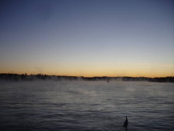
The night had been clear and cold.
In the light of the full moon, we could see the thin layer of fog
forming on the water surface. When the air is much colder than the warm water, the chance
for surface fog exists. It was
absolutely beautiful in a slightly eerie way.
We had the opportunity to put the radar and GPS to good use until the
sun burned off the last remnants of the wafting fog.
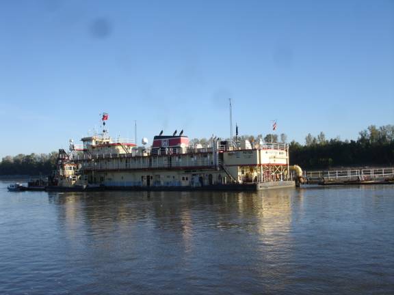
The US Army Corps of Engineers has the responsibility for maintaining
the navigable channels along the western rivers.
This requires that certain areas be dredged out frequently to provide
enough depth for vessels to pass. The
dredge “Potter” was busy pumping mass quantities of sand, mud and water
out of the channel into adjacent “spoil areas”.
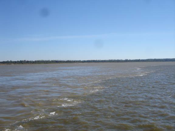
Upon reaching Mile 0.0, we crossed the line at the confluence of the
Mississippi River and the Ohio River. Since
bodies of water that are different temperatures do not mix well, there is
often a clear line visible were the two attempt to meet.
These waters are different colors due to the suspended sediments thus
making it easy to see the delineation.
We had experienced a following current on the Mississippi River flowing
southward. Our turn onto the Ohio
River occurred at 10:45 am and Mile 981.0 near Cairo, Illinois. (pronounced
“KAY-ROW”). The river starts
in Pittsburgh, PA, however, our trip will only take us about 60 miles to
Paducah, KY. The river currents
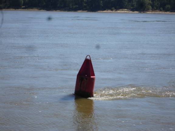
that had helped us previously are now slowing us by nearly the same amount.
You can easily see the effect of those currents on this red Nun buoy.
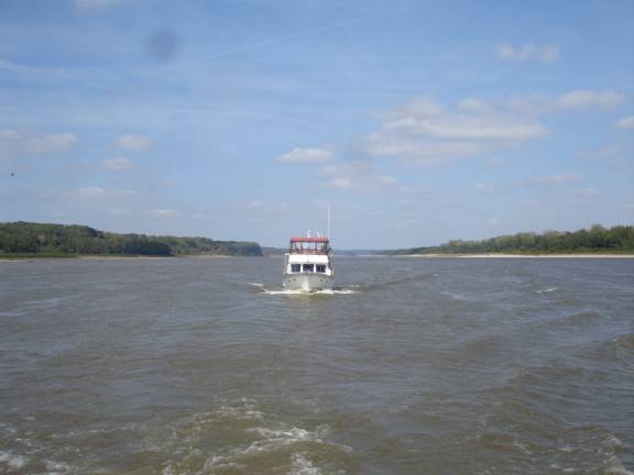
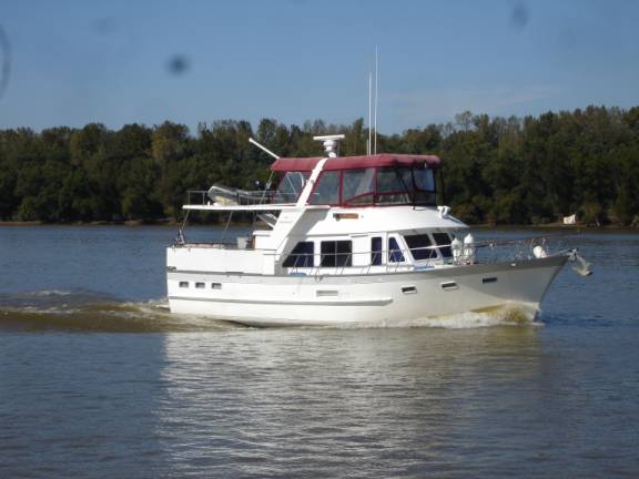
“Missy
B” can travel just a little faster that we can.
We let her take the lead this time.
Lock #53 is located at Mile 962.6.
It has a “wicket” dam associated with it.
In periods of high water, the dam is actually lowered down below the
surface allowing the river to flow unimpeded.
Once again, “Lucky Larry” brought the good fortune and we were able
to continue upriver without the need to enter the lock.
At the recommendation of some other “Loopers”, we selected an
anchorage area behind a submerged sand bar at Mile 949.2.
Larry led the way and was able to get a good anchor set on the first
attempt. We were not so
fortunate. It took us 4 attempts
before we were able to get a solid bite in the gravel bottom.
10/08/06 MILE 949.2 ANCHORAGE TO GREEN TURTLE BAY, GRAND RIVERS, KY
At the agreed upon time of 6:30 am, both boats hoisted anchors and
rejoined the main channel of the Ohio River.
Since the bottom was gravel, we had no muddy cleanup to do on the
anchor. We had slept well and
held tight.
Once again, it is good to be traveling with “Lucky Larry”.
At Mile 939.0 and Lock #52, the “wicket” dam was down and we are
able to pass without hindrance.
We had two choices to reach Green Turtle Bay.
The first is to turn up the Tennessee River at Paducah, Kentucky.
The second choice would be to continue further along the Ohio River and
turn up the Cumberland River. Most
pleasure boaters choose the Cumberland River route. Although it is a longer distance, there is generally a
shorter wait at the lock into Barkley Lake.
The Tennessee River route is about 20 miles shorter, however, the lock
into Kentucky Lake is notoriously delayed due to intensive commercial traffic.
If you were traveling with “Lucky Larry”, what would you choose?
Alright, we’ll try the Tennessee River.
At 8:36 am, we left the Ohio River at Mile 935.0 and veered onto the
Tennessee River at Mile 0.0.
We immediately saw an increase in our speed since we had left the
stronger currents of the Ohio behind. At
Mile 22.2 is the huge Kentucky Dam and Lock.
Boaters often talk about having many, many hour delays and some even
days of delay to get through this lock. What
would happen to “Lucky Larry”? You
guessed it. The lockmaster said
if we would hurry, he would have the lock gates open and slide us up between
two double-size, commercial tows. So,
we unbelievably zipped in to the lock and were lifted the 57 feet into
Kentucky Lake without any delay.
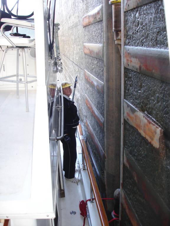
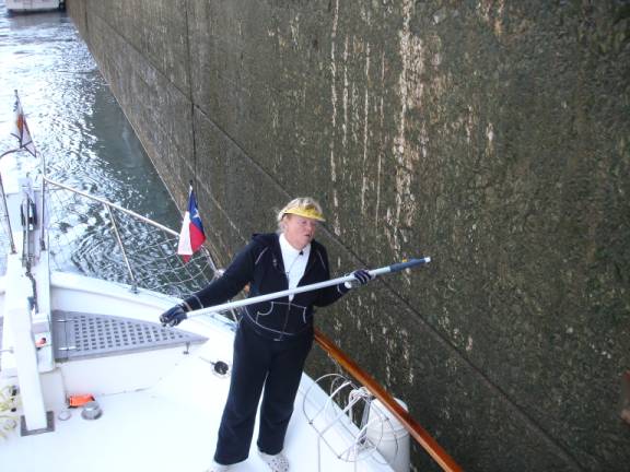
Take careful notice of the expert technique that Judy skillfully
applies. The line is perfectly
wound around the bollard and she maintains the fore and aft balance using the
boat hook. Is that a terrific gal
or what?
The lockmaster told us that if we were only a few minutes later, our
wait would have been at least 3 hours. At
11:45 am, we motored out onto the lake. A
manmade canal links Kentucky Lake with Barkley Lake.
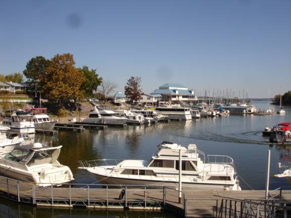
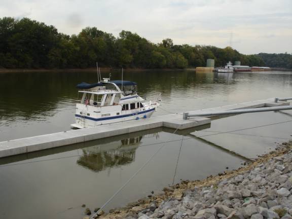
Within about 45 minutes, we were entering the channel to Green Turtle
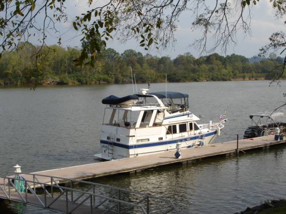
Bay. This is a favorite marina for “Loopers”.
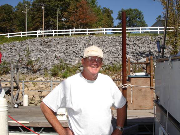
I know you’ve been wondering, so, here is a picture of “Lucky
Larry”. Larry Goby is the
captain of “Missy B” from the port of McAllen, Texas.
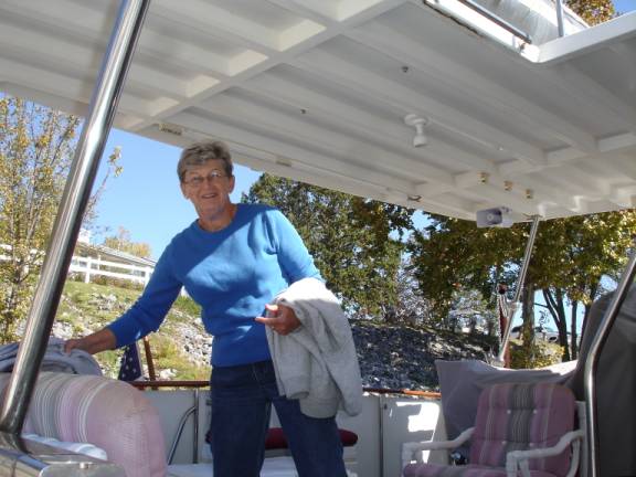
This is the lovely Doris Goby. The
real reason he is called “Lucky Larry”.
We had a wonderful cocktail hour and dinner together to celebrate
another milestone toward the completion of our “Loop” voyage.
Patti’s 1800 Settlement Restaurant is well known for their delicious
meals. Judy had their specialty of 2 inch thick pork chops.
I had a chicken dish with country ham, cheese, and some other stuff.
It was fantastic. The
restaurant does something quite unusual.
They actually bake bread inside a clay flower pot and then serve it hot
and still in the pot. Pretty neat. 10/09/06 MONDAY GTB, GRAND RIVERS, KY TO BUMPUS MILLS MARINA
Judy and I have talked a lot about taking a side trip to explore the
Cumberland River. The trees are
changing to fall colors and folks say the trip is beautiful.
Of course, we love to branch out just to see what’s around the next
corner. I guess it’s a form of
natural curiosity. Anyway, we were expecting good weather for the next few days
according to the forecast. Our
friends, Larry and Doris, will rest here at Green Turtle Bay for at least
another day before rushing back to Texas.
We bid them farewell, filled our fuel and water tanks, and, at 11:35
am, departed the harbor headed upriver on the Cumberland River from Mile
31.7.. This river extends about
380 miles to Celina, TN. We
don’t know how far we’ll go, but we will go until we turn around.
We will have to return here since the river does not connect further
up.
The afternoon was nearly perfect and the scenery spectacular.
We both agreed that it was far better to be out here on the water than
roaming around at the marina.
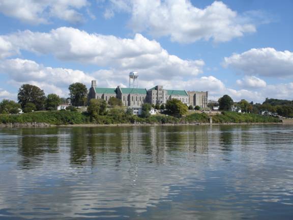
Along the RDB (right-descending-bank) is the famous “Castle on the
Cumberland.” It is the
Kentucky State Penitentiary, the only maximum-security prison in the state.
More that 160 inmates have died in its electric chair.
In fact, on a July Friday the 13th in 1928, seven men were
executed here, a record that still stands in the United States for the most
legal executions in one day.
At 4:24 pm, we crossed the state line into Tennessee.
The huge dam, back at mile 30.8, has created this section of river
known as Barkley Lake. The
winding section of river led to a narrow turnoff into an embayment at mile
77.4.
We are using a guidebook written by Fred Myers.
His work is excellent and is the most comprehensive treatise on the
river. His recommendation for
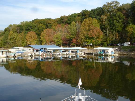
Bumpus Mills Marina led us back into a secluded, remote grouping of small
buildings and covered docks. You immediately get the impression that this is a
fisherman’s paradise. We were,
by far, the largest boat there.
They fit us in alongside the office building and, at 5:10 pm, helped
hook us up for the night.
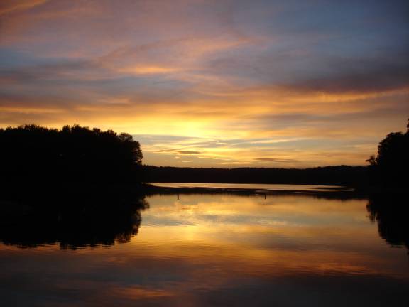
It was interesting watching the fishermen return that evening and we
certainly enjoyed the restful solitude. The
sunset may have equaled the beauty of any that we’ve seen on our trip.
10/10/06
TUESDAY BUMPUS
MILLS, TN TO
CLARKSVILLE, TN
The night had been quite cold which brought a dense fog to this area of
warmer water. We delayed our departure until 8:10 am. In the embayment, the fog had lifted to very light, however,
as we entered the main river channel, the fog thickened within a few miles.
We relied on the GPS and Radar to help navigate in the reduced
visibility. It was amazing how
many fishermen had ventured out in this stuff.
By 9 am, the fog was nearly gone and the weather became wonderful.
It is quite interesting reading about the activities, engagements, and
battles that occurred in this area during the Civil War.
It was along this very river that Union General Ulysses S. Grant gained
national prominence with his victory at Ft. Donelson.
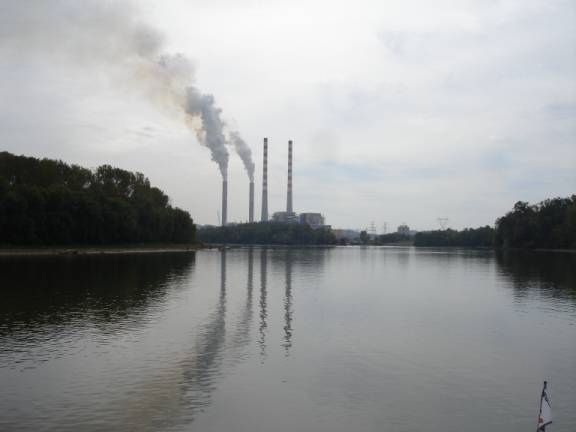
The Tennessee Valley Authority (TVA) Cumberland Steam Plant was one of
the world’s largest when it was completed in 1973.
The 1000-foot stacks are now dormant having been replaced by the two
600-foot stacks with scrubbers to reduce pollution.
Many millions of years ago, a giant meteorite, more that 20 miles in
diameter, struck earth in this area. Although
the crater has eroded away, a nearby hill has been identified as the center of
the rebound area.
The City of Clarksville, TN has recently opened a
brand new municipal dock facility. The
free dock is managed by the Parks and Wildlife Department and is available for
overnight stays. It is terrific
to see these communities boosting their economies from increased traffic on
the river. The concrete dock is
conveniently located to the historic district and several restaurants.
A nearby bus transit site makes city bus travel available to many city
businesses.
At 2:05 pm, AMARSE was secure at Mile 126.0.
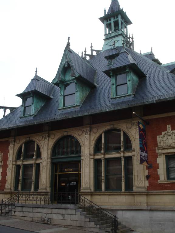
We walked around the lovely historic district of the city.
Built in 1898, this building served as the US Post Office and Customs
House. It features a variety of
diverse architectural styles blended together.
It now serves as the Clarksville-Montgomery County Historical Museum.
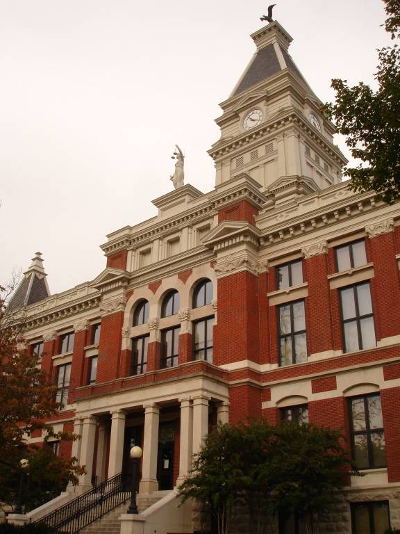
The historic Montgomery County Courthouse has been artfully
reconstructed and restored to satisfy present day needs.
It was recommended that we try the New China Buffet and Grill located
just downriver along the lovely river walk.
It was excellent and the chilled, boiled shrimp were the highlight for
me. POSITION:
N36 31.802 W087 21.893
Mile 126.0 10/11/06
WEDNESDAY CLARKSVILLE, TN
TO ASHLAND CITY, TN
We had hoped for an early departure, however, the early morning was
quite rainy. We walked over to
Mrs. Winner’s for a breakfast of cinnamon rolls and steak/egg biscuits.
We began to make way at 8:15 am. The
rain had subsided and, although the forecast called for 70% chance of rain,
the sky looked as though it was clearing up.
At 11 am, we arrived at the Cheatham Lock.
We would have to wait some time for a commercial sand barge tow to lock
through. It was 12:50 pm as we exited the Cheatham Lock at Mile 148.8
and continued upriver. Created by
this huge dam, Cheatham Lake has 7,450 acres of backwater with a shoreline of
320 miles.
Our delayed departure, combined with the delay at the lock, made our
planned upriver destination impractical.
We opted to stop at the small Riverview Marina & Restaurant dock at
This is off-season in these parts and we didn’t see another cruiser
all day. There doesn’t seem to
be much pleasure boating going on right now.
Most of the “Loopers” have gone further south by now.
The Rendezvous at Joe Wheeler State Park in Alabama is going to start
this coming week. We were unable
to get reservations because they were sold out. They had to turn away quite a
number of us. Too Bad, So Sad.
The restaurant is a local favorite and has a nice salad bar.
Judy tried the catfish and I enjoyed the Chop Steak. POSITION:
N36 16.118 W087 04.588
MILE 158.0
The next installment UPDATE will continue with our voyage along the
Cumberland River. I don’t want to make these email postings too large for
some of the computers that have slower internet services. I’ll try to get the next one out soon and eventually catch
up. Thanks for your patience. ATTENTION:
SPECIAL NOTE:
My Verizon AirCard that operates my computer internet still operates
slowly and sporadically. The
coverage areas are not as good as we had hoped.
We will be sending out updates when we can.
Judy has Cingular Wireless cell phone service.
It seems to work even better than the Verizon Wireless.
Judy can be reached at 361-550-5353
and Fred can be reached at 210-296-4933.
We can be reached at either number.
Please call us if you like, we’d really like to hear from you. "AMARSE".
is pronounced "AM-ARE-SAY". Our website is: www.amarse.net
. Check
it out while we will attempt to keep you informed via email
We would like to hear more about what is happening in your lives.
Let us know as we very interested in what’s going on with our friends
and family. Please call or email us with your thoughts and comments
and ideas too. Thanks Lot
of Love, Fred
Reed and Judy Law AMARSE MT40
|
|
Fred H. Reed |
www.amarse.net © 2006 2007 2008 2009 2010 2011 |