|
|
|
|
Site Index:
In this Section:
|
UPDATE #8 05/28/06 - 05/31/06
Howdy
Everybody, UPDATE
#8 5/28/06
through 05/31/06. Previous
email updates covered the period 4/1 thru 5/27.
I know some of you have slow speed connections.
Please let me know if these emails containing pictures are too large
and we will send you a version with text only.
05/28/06
Sunday Annapolis,
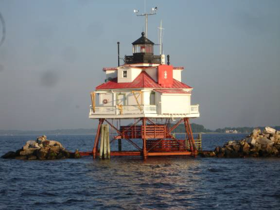
MD to Sassafras River, Georgetown, MD At 5:50am, the deckhands dropped the mooring line and we idled toward the Spa Creek drawbridge. We arranged for the 6am opening that led us into the Annapolis main harbor and out past the US Naval Academy. The sunrise was super. Several miles to the south lies Thomas Point Lighthouse. We decided to get close up and personal for the “Kodak Moment”. The early morning light made for some nice shots.
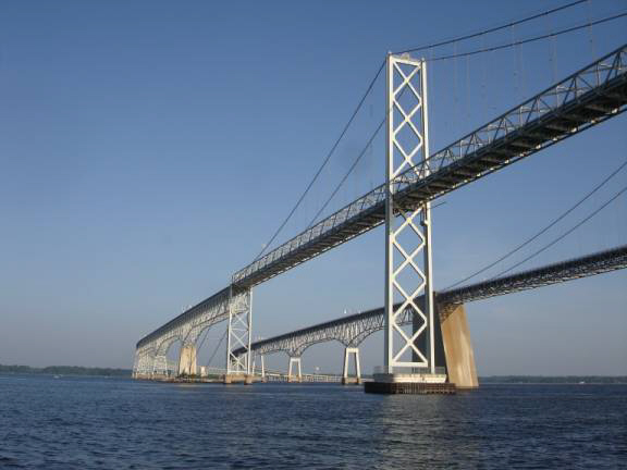
Turning back northward, we proceeded toward the Bay Bridge and along
the Chesapeake Bay.
At 11 am, we turned into the Sassafras River.
There were a phenomenal number of SeaRays and other fast boats
zipping around and stirring up some pretty big waves and wakes.
We bounced along up past Georgetown, through the drawbridge, and into
Greggs Neck. At
1:15, the anchor was set for an afternoon of relaxing.
We were waiting for a call from Joe DeMaris and friends to arrange
the afternoon cruise.
JD, Skip, and Dave were out flying from West Virginia.
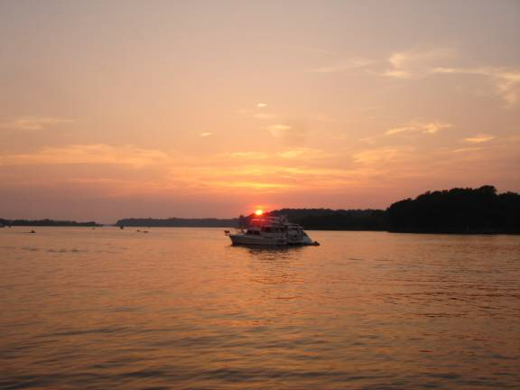
About 4pm, we cruised back to the Georgetown area.
It was lovely and warm and lots of fun to watch the numerous boats
cruising around. We
arranged to pick up JD at Skipjack Marina where we refueled the boat.
After cruising around for a couple hours, we anchored and Judy and
Donna prepared a spectacular dinner for the six of us. Joe
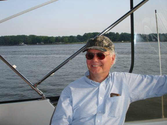
DeMaris:
Dave
Smith:
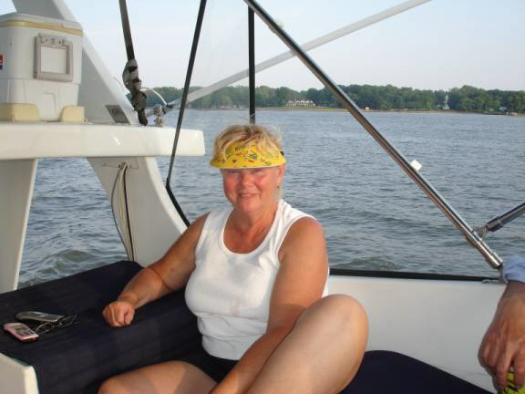
Judy
Law:
Before we knew it, the evening had turned to pitch dark.
Time had flown too fast and, with running lights illuminated,
returned to Skipjack Marina.
With friends departed, we inched our way back to the same location to
anchor for the night.
So much for that plan, we had made several attempts to get the anchor
to hold but to no avail.
Slowly, we relocated to a little cove off the channel just north of
marker R10. Here
we had a successful anchoring the first shot.
It was now about 11pm and the crew had been worked hard.
Off to bed now for an early go in the morning.
05/29/06
Monday Memorial Day
Sassafras River to Cape May, NJ Happy
Birthday to my sister Carol (whose real name is “Carol Edith Ann
Elizabeth Joan Camille Pocahontas Reed Kennedy), otherwise known as “ScrapCat”. Today
is Memorial Day and another opportunity to pay our respects to those brave
soldiers, sailors, and other defenders of our country who paid the ultimate
price with their lives that we might have the chance to enjoy freedom.
We, aboard AMARSE, will enjoy that freedom and we offer our deepest
gratitude to our fallen comrades who helped make it possible. It was
a very short night as we started anchor up at 5:10 am.
The Fortress anchor was caked with mud, fishing line, rags, and
sticks. What
a mess. Twenty
minutes of cleanup work had us motoring out the Sassafras toward the bay.
Continuing north, we completed our visit to the Chesapeake Bay as we
entered the C&D Canal.
The Chesapeake-Delaware Canal joins the two bays of the same names.
The current was swift but fortunately in our favor. AMARSE was “Smokin’”
as we hit speeds as much as 12.9 miles per hour.
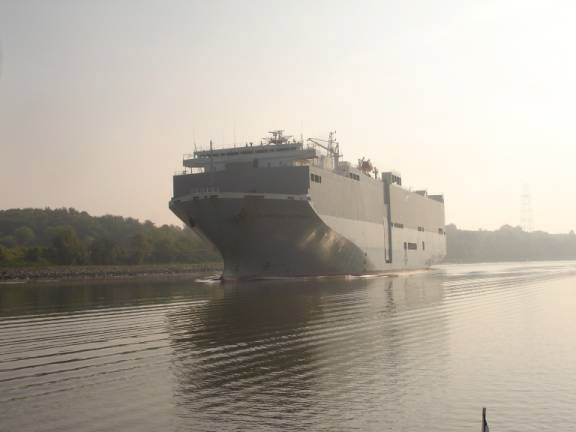
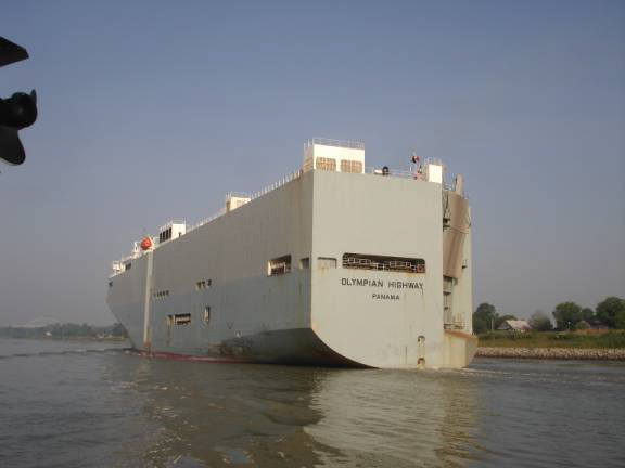
We shared the canal with some huge commercial vessels before exiting
into the often hostile Delaware Bay at Reedy Point.
It
was quite hazy so we chose to follow a course just outside the main channel
buoys. This
would allow shipping traffic to have all the channel while we had safe
depths of water. At
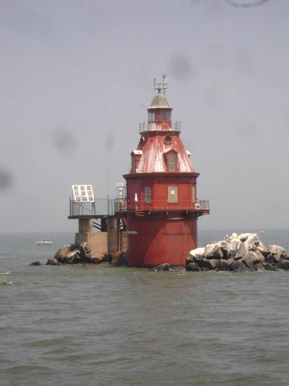
about noon, we approached the “Ship John Shoal Lighthouse.
There were lots of good ole’ boys out fishing around the shallows
on this holiday weekend.
AMARSE slowed to reduce our wake and give us an opportunity to snap
some pictures.
We set
a rhumb line course to our destination markers at Cape May, NJ.
The winds and seas had picked up significantly and AMARSE was getting
soaked with the resulting spray.
This was yet another time when we were glad for the isinglass
enclosure. As we
came through the jetties at Cape May, the recreational boat traffic was
quite heavy as the holiday weekend was coming to its end.
We chose an anchorage near the US Coast Guard training station for a
peaceful, secure night.
Today, we had visited three states: Maryland, Delaware, and New
Jersey. I set
to work on repairing a split hose leak in our anchor washdown system.
I was able to make a temporary repair that will suffice until we can
get some new parts.
All the twisting and turning in tight spots made me quite tired and
achy. The
effort was worthwhile though as the washdown pump is such a very important
piece of equipment on this trip. Position
N38 57.046 W074 53.040. 05/30/06
Tuesday Cape May,
NJ to Island Heights, NJ on Tom’s River
With anchor aweigh at 5:30, Judy and Donna worked hard to wash the
very sticky, black mud from our ground tackle.
We had anchored close to the famous Cape May Inlet and we were able
to turn north near the sea buoy before 6 am.
What a gorgeous, big orange ball sunrise, it was. Another
trawler was close in trail.
I hailed the trawler “Vide Poches” and we discussed our plans for
the passage up the “outside route” of the Atlantic Ocean.
Their vessel name means “empty pockets” in French.
Its, perhaps, a well fitting name for this kind of lifestyle. The
outside route remains fairly close to the shores and sandy beaches of New
Jersey as we travel only 2 to 5 miles offshore.
Something interesting that we encountered
were many, many, perhaps hundreds, of those Mylar balloons floating
in the ocean. You
know the kind, the shiny silver ones, some with heart shapes, and imprinted
with various greetings.
They obviously loose enough helium that they settle to the surface
and float forever more.
Who knows how many of these will accumulate out there since that
plastic probably never biodegrades.
I, personally, had never considered what happens to all those helium
birthday balloons that are released everyday.
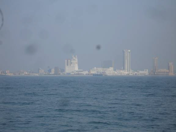
Enroute, we could see Atlantic City through the haze.
Big and beautiful casinos lined the shore.
The largest is the “Taj Mahal” of Donald Trump fame.
Most people agree that the beaches along the New Jersey shore are
quite nice.
The sea state was conducive for an attempt at Barnegat Inlet.
This famous, or perhaps infamous, pass from the Atlantic Ocean to the
inland bay can be either viciously treacherous or, at least, challengingly
tricky. Waters
in the initial inlet should never be attempted during inclement weather.
Waves, breakers, currents, eddies, and shifting shoals can make the
inlet uncontrollable.
For us today, the conditions were relatively mild and provided an
excellent opportunity to experience this unique inlet.
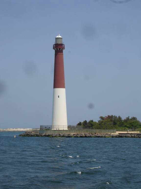
The rock jetty inlet leads passed Barnegat Light.
Commissioned in 1859, the 165 foot tall beacon is the second largest
lighthouse in the United States.
A very twisty, turning channel, narrowly bordered by sand shoals,
requires full attention and careful navigation to avoid danger.
The shoals here shift so frequently that they are not marked on any
of the charts and the buoys are constantly being relocated.
The passage through the inlet and through the complex Oyster Creek
channel took right at one hour.
In these favorable conditions, it was certainly a wonderful
experience. It
was easily the most complex channel that I have ever encountered.
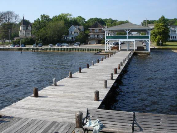
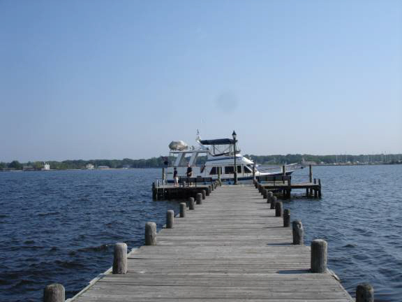
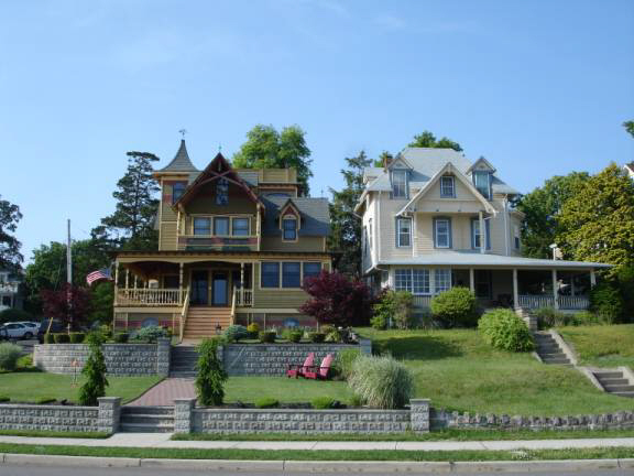
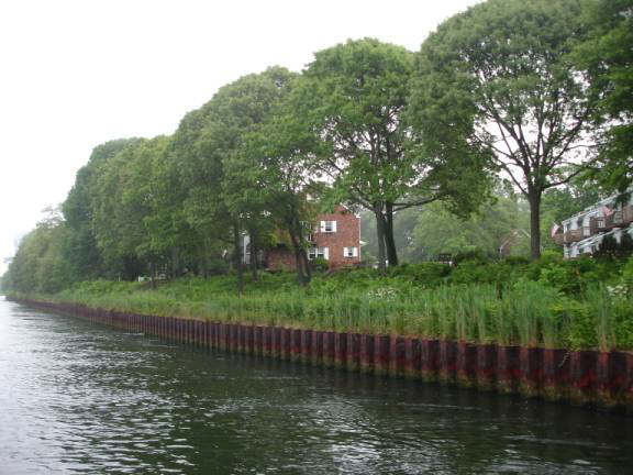
Now in Barnegat Bay and the NJ ICW, we proceeded to Tom’s River.
The state marked channel took us 1.8 mile to the lovely community of
Island Heights. Although
with a little difficulty, we were able to locate the city dock adjacent to
the open-air building with a green roof and green trimmed side boards.
At this time of year, the community allows boaters to tie up free of
charge. How
does one turn down a deal like that?
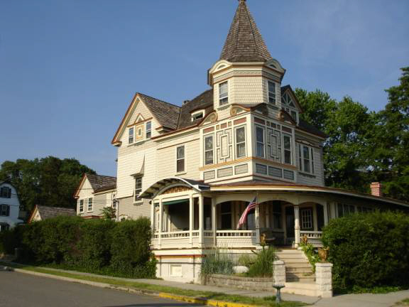
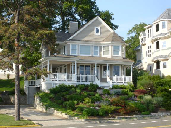
The
weather was so nice and the streets lined with historic Victorian style
homes made our afternoon walk along a boardwalk extremely pleasant.
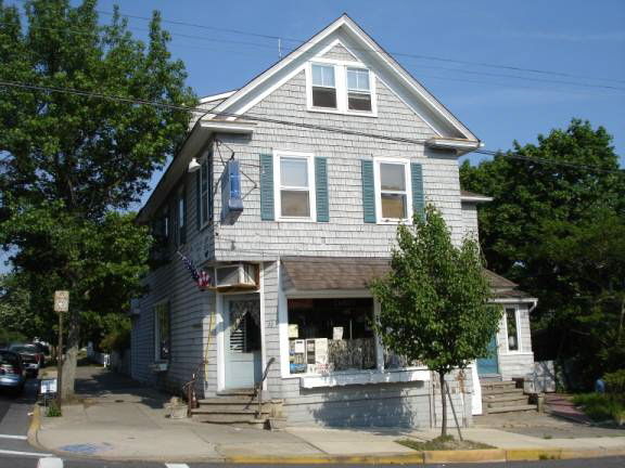
Some local folks informed us of a great restaurant to try located
only a block or so uphill.
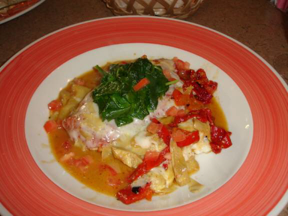
We made the required reservations and dined at the “Old Corner Deli”.
Uniquely located in an old home and corner store, this little place
serves as a deli during the day.
At 5pm, the deli closes and they open the home dining room consisting
of only 8 or 10 small tables.
This is gourmet dining and the meals are wonderfully prepared.
Should you ever visit, remember to bring your own bottle of wine
since BYOB is protocol.
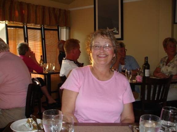
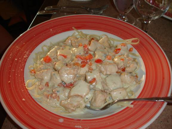
The gals thoroughly enjoyed the Breast of Chicken Chunks with 5
cheese Alfredo Linguine while I savored the Chicken Antipasto, a tender
chicken breast medley combining pepperoni, sautéed peppers, and a blend of
melted cheese. This
is a good place and don’t miss the fresh, warm bread rolls.
A
quiet, relaxing evening was getting us rested for another early morning. Position
N39 56.409 W074 09.014 05/31/06
Wednesday Tom’s River,
Island Heights, NJ to Statue of Liberty
By 5:40 am, I had checked all the engine fluids, warmed the engines
up, and was turning the propellers while Donna and Judy cast off the
docklines. We
rejoined the ICW at mile 14.7 and coursed our way in rather foggy
conditions. At
times like these, the radar and GPS chartplotter are extremely useful.
The Point Pleasant Canal is an interesting place that is very narrow
and its banks are lined with heavy steel plate pilings.
The
current roars through here creating eddy and whirlpool currents that make
for an interesting and somewhat hazardous situation.
For me, these types of challenges make our trip lots of fun and
serves to heightens my enjoyment.
The fog seemed to thicken as we approached Brielle, NJ.
The railroad bridge was down and we loitered a short while before
passing into the Manasquan Inlet.
The traffic was plentiful with numerous large fishing boats vying for
positions in the line exiting to the Atlantic Ocean.
It seems that everyone is scheduled to depart at 8 am.
The fog was quite thick and the boat wakes rather intense.
It requires constant vigilance to keep in safe conditions.
We probably would have waited out these foggy conditions, however,
the forecast was for deteriorating conditions that could create more of a
problem than the fog.
The lesser of the evils philosophy proved to be our best choice.
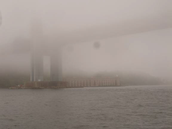
As we rounded Sandy Hook Point to enter the mouth of New York Harbor,
the fog had only lifted slightly, however, as we slid under the Verranzano
Narrows Bridge, the fog evaporated providing us a wonderful, clear view of
our approach to Manhattan Island and the Statue of Liberty.
The commercial shipping traffic was moderately hectic but provided
for a very interesting trip. Ships, tugs, barges, ferries, police boats,
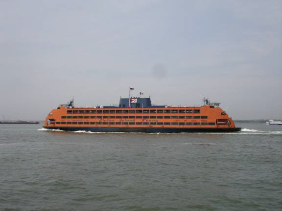
fire boats, and the famous Staten Island Ferry all vying for position with
AMARSE.
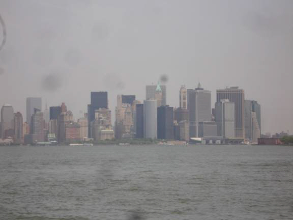
The Empire State Building, the Chrysler Building, Wall Street, and
the Brooklyn Bridge were clearly evident.
Actually seeing these landmark sites from the deck of our own boat is
a truly remarkable experience.
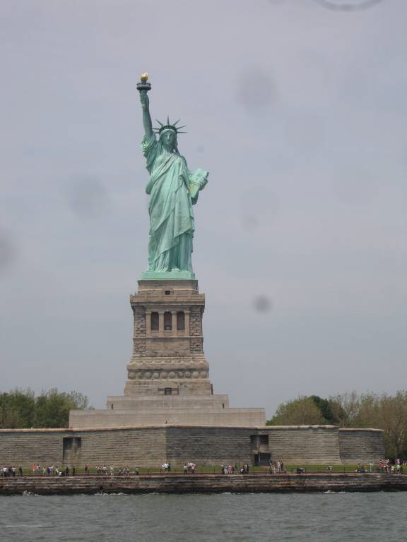
The Lady of the Harbor stands so tall and prominent and the backdrop
of the city skyline so compelling that it would take a very hardened person
not to be in awe. Here,
the “WOW” factor is really high.
I brought AMARSE right up close to the security markers giving us the
best possible view as we slowly arced around her massive base and structure.
These views and glimpses of Ellis Island reminded us all of our
history classes in school that now seem so close in mind.
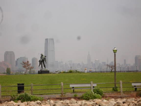
A narrow channel leads back behind the Statue leads to Liberty State
Park and our somewhat breezy anchorage for the night.
There, we shared the spot with four other cruisers.
This was far fewer than we expected.
Perhaps the fog conditions had discouraged them.
Judy prepared Tuna sandwiches served with chips. It was too windy to grill and, perhaps, all these thoughts of history classes reminded us of our school lunch days so much that this was the perfect meal choice.
POSITION:
N40 41.726 W074 03.753. "AMARSE".
is pronounced "AM-ARE-SAY". Our website
is: www.amarse.net . Check
it out while we will attempt to keep you informed via email.
We have had the pleasure of hearing from many of you.
We would like to hear more about what is happening in your lives.
Let us know as we very interested in what’s going on with our
friends and family. Please DO email us with your thoughts and
comments and ideas too. Thanks Lot of
Love, Fred
Reed and Judy Law AMARSE MT40
|
|
Fred H. Reed |
www.amarse.net © 2006 2007 2008 2009 2010 2011 |