|
|
|
|
Site Index:
In this Section:
|
UPDATE #20 08/16/06 thru 08/24/06
Howdy
Everybody, UPDATE
#20 08/16/06 through
08/24/06. The
period 4/1 thru 8/15 has been covered in Updates 1 through 19.
We
are very interested in hearing from ya’all.
If you have missed out on any of the previous emails and would like us
to re-send them, please let us know. Please
let me know if these emails containing pictures are too large and we will send
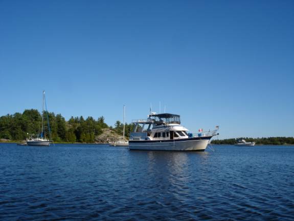
you a version with text only. 08/16/06 WEDNESDAY LITTLE CURRENT, ONTARIO TO STURGEON COVE, BAY OF ISLANDS ANCHORAGE HAPPY
BIRTHDAY TO FRED’S SISTER, DONNA BROWN.
It was a beautiful, sunny morning here Little Current.
The strong winds of the last few days have subsided and we are anxious
to continue our boating. This is
the first day in the last 5 that the wind has not been howling.
I’ve had a hankering for blueberry pancakes for some time now.
We had bought a box of berries and this seemed like the perfect morning
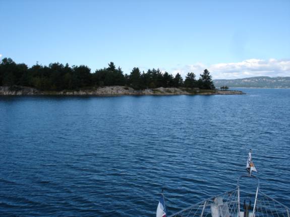
for them. They were delicious. When we were ready to depart, the dock guys had locked themselves out of the office so we couldn’t pay up. We had to wait quite a long time before they got some keys to open up. At 11:05 am, we were finally off the dock headed westbound for the Bay of Islands. Clear of the Little Current channel, we turned north up the Waubuno Channel.
We cruised a short way up the bay and into Bell Cove.
It looked nice but the smaller cove just east looked even more
inviting. The guidebooks warn to use extreme caution when entering this
cove due to shoals and rocks. We
eased in with Judy perched at the bow to eyeball any shoals.
We picked our way in without much trouble as the sun was high and water
calm. These are absolute
requirements to “reading” the water.
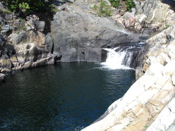
Down came the dinghy for some exploration.
We set out eastbound and enjoyed a very scenic trip to the little
community of Whitefish Falls. A
little more exploration up the river led us to a wonderful surprise.
We came across the falls for which the town was named.
We climbed among the rocks and enjoyed the sunny afternoon around the
falls.
Our return trip was through a different route with even more twists and
turns. As we emerged into the
bay, we had to endure some pretty rough conditions.
We bounced and bounced and bounced.
Judy would become airborne from her seat and even be jarred over on the
seat. This would throw the dinghy out of balance requiring us to
slow way down and restart our way. It
was probably the roughest dinghy trip we’ve had to date. Our anchorage was very smooth and comfortable. POSITION:
N46 02.970 W081 54.734 08/17/06 THURSDAY STURGEON COVE TO CROKER ISLAND, THE BENJAMINS ISLANDS
At 10 am, we raised the weedy, muddy anchor.
Judy stayed on the bow to help guide us out of the tricky mouth of the
harbor. Out of the Bay of Islands, we moved westward and entered the
Benjamin Islands from the south near Secretary Rock. As we proceeded north and west of Porcupine Island, we were
greeted to the flashing blue lights of the O.P.P. patrol boat.
The Ontario Provincial Police positioned themselves to board us.
We were introduced to two Canadian Customs Officers.
The OPP operates in joint task force with Customs in these waters.
The very polite officers asked numerous questions about our travels in
Canada and were interested in the procedures we used when originally entering
Canada. Since we had been cleared
via telephone initially, they requested to inspect the vessel.
The thorough search took about a half hour.
We thanked them for their courtesy and they issued us a blue card and
bid us “good trip”.
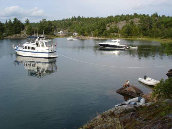
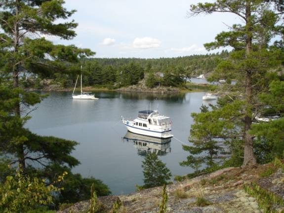
Around the back of Porcupine Island and in a bight of Croker Island, we
found an ideal spot to drop the bow anchor and chain.
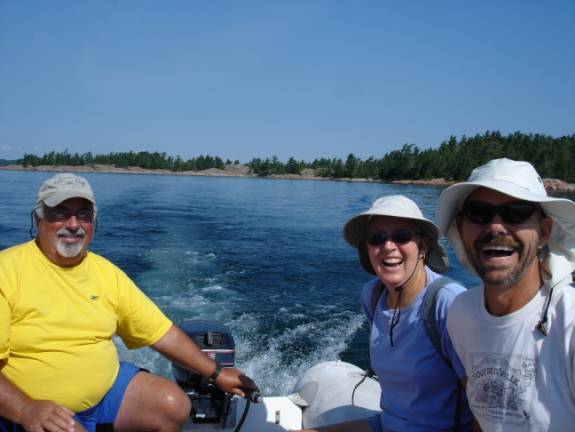
A nice guy from a SeaRay boat came over in his dinghy to assist us with
the stern tie. He was a great
help and we were secure in short order.
We heard a radio call from our friends on “Happy Clamz”.
We zipped over to the adjacent island between North and South Benjamin
to visit with Doug and Leslie. After
a while, we set out to explore a narrow pass that we had read about.
We saw a 28-foot Bayliner type boat approaching the pass.
We ran the dinghy out to them and asked if they were familiar with the
pass. He indicated that he knew
the way and we said “OK” with a warning to be careful because of the
shallows we had seen. We followed
as he proceeded and soon he had run aground on a rock ledge.
We worked with our dinghy, Doug’s dinghy, and the guy’s dinghy.
We finally freed him. Perhaps
he had a little prop damage and little or no boat damage.
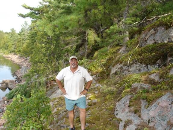
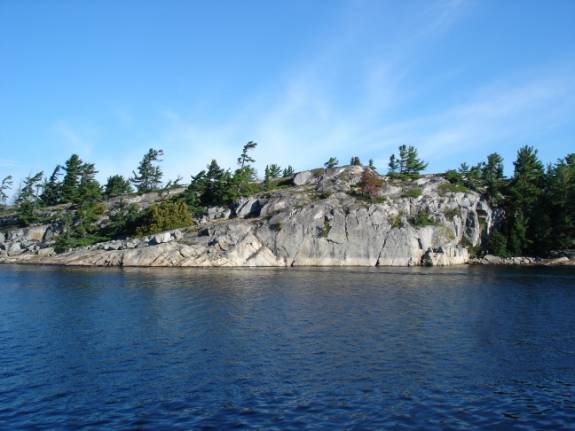
The rock cliffs behind AMARSE begged to be climbed and I obliged.
The views of the surrounding islands and the beauty of the North
Channel waters were awesome. With the water at 70.8 degrees and the air temp of 73, it was
another perfect opportunity to bathe in these crystal clear waters.
The grill seared some of Emeril’s Chicken/Apple sausage that went
deliciously with Baby Red Mashed Potatoes, a salad, and some chunky
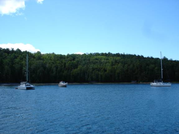
applesauce. 08/18/06 FRIDAY CROKER ISLAND, THE BENJAMINS ISLANDS, NORTH CHANNEL
Another beautiful, calm morning. We
set out in the dinghy for more exploration.
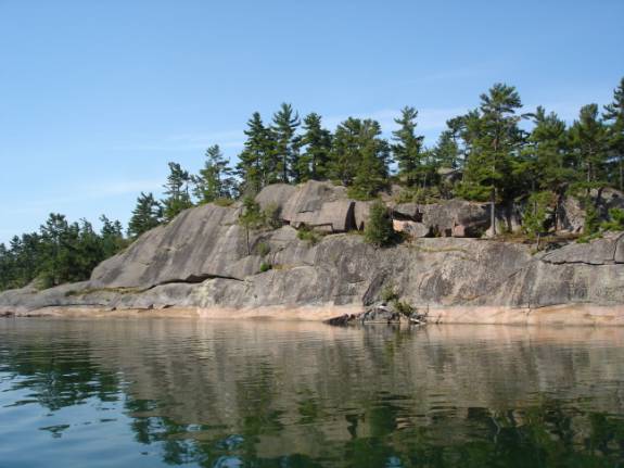
A circumnavigation of South Benjamin Island revealed numerous wonderful
anchorage opportunities.
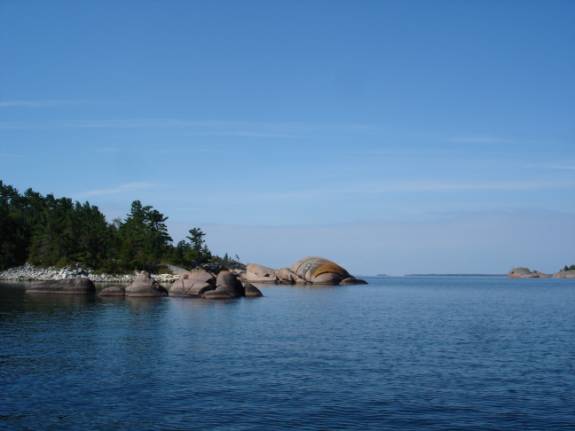
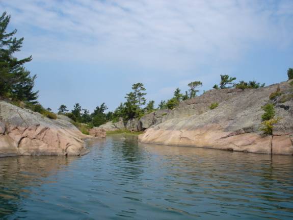
This chain of islands may well be the prettiest that we’ve ever seen.
The pink colored granite contrasts beautifully with the white quartz
and is accented with the numerous shades of green from the trees and shrubs.
We asked Doug and Leslie to join us in the dinghy for another tour of
the south island.
Later, Judy and I set out to explore the North Benjamin Island and Fox
Harbor on Fox Island. It was a great afternoon for lunch, swimming, bathing, and a
nice little nap.
Don and Roseann from “Mick’s Rose”, and Doug and Leslie from
“Happy Clamz” joined us on the sundeck of AMARSE for cocktails.
Doug and Leslie stayed for dinner.
Tonight, I did DVD backups for the photos on my computer.
I have been worried about losing them should we have computer troubles. POSITION:
N46 04.543 W082 12.906 08/19/06
SATURDAY CROKER ISLAND,
THE BENJAMINS
As per the forecast, the overcast skies and breezy conditions
prevailed. We decided that this
was a great place to “hole up” and relax.
To add to our security, we placed an additional bow anchor out off our
starboard side. We used a 35-pound Delta plow anchor with 30 feet of chain
and another 75 feet of nylon rode. This
proved to be a good move when the wind came around and both the stern line and
the starboard bow anchor were strained taut.
I took the opportunity to review my charts and guides for information
about our upcoming routes. This prepared me nicely for an afternoon nap.
4 pm cocktails were being shared on “Mick’s Rose”.
It was cold, the rain was pouring, and it was very windy.
Additional guests from the sailboat “Escapade” were uneasy about
their security on a single anchor. Fortunately,
they held just fine.
It was the perfect night to be warmed up with some Homemade Chicken
Rice Soup. 08/20/06 SUNDAY CROKER ISLAND TO MOILES HARBOR, JOHNS ISLAND HAPPY BIRTHDAY TO JUDY’S SON, MARK LAW IN LUFKIN, TEXAS
We started the up anchor routine at 9:45 am.
We had to work hard to retrieve the starboard anchor.
I had to pull it up by hand and it was caked with clay mud.
Here is how we did it. I,
firstly, tried to raise the starboard plow anchor into the dinghy.
It would not budge. OK,
then, we untied and retrieved the stern line.
Hand over hand, I pulled up as much rode and chain as I could.
Now pivoting on the main bow anchor, I motored the boat to pull the
starboard anchor loose. I could
now pull up the heavy plow by hand and slosh it to clear the clay mud.
Now up over the side rail, we washed of the rest of the mud.
Next, the main bow anchor was hauled up using the windlass and motoring
to pull it out of its muddy hold. It
took a while longer to clean it up too. The
clock showed 10:20 am as we finally picked our way out of our anchorage. We were nearly exhausted by the effort. Fortunately, the weather was in full cooperation and the
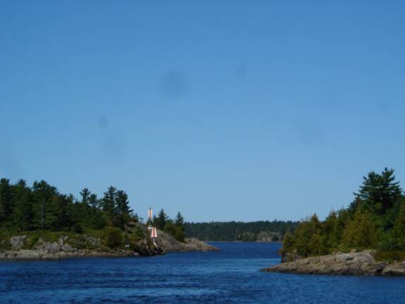
scenery was wonderful for our route through MacBean Channel.
We made our security announcement over the VHF marine radio and passed
through the very narrow, rock-lined passage of Little Detroit Cut.
A few zig zag turns brought us into Whalesback Channel.
We had chosen to try Moiles Harbor at the eastern end of Johns Island. We were told that it was a real pretty place but littered
with “deadheads”, or partially submerged logs.
The cove had been the sight of a lumbering mill many years ago.
Some of these logs have been laying around for around a hundred years.
Judy kept a sharp-eyed bow watch while we eased into the beautiful
little harbor.
In our quest to locate the underwater hazards, we made the regrettable
mistake of forgetting about our dinghy being towed on a fifty foot line.
As I backed slowly, the line became entangled in our portside
propeller. After finishing our anchoring, I prepared to free dive under
the boat to examine the extent of the tangle.
Fortunately, the water is very clear and fairly warm.
It took almost two hours to finally free all the line.
Judy had bought a wonderful, heavy duty serrated kitchen knife with
just this purpose in mind. We had
envisioned tangling with someone else’s line rather than our own.
The knife worked perfectly and we would recommend our cruising friends
to invest in a similarly strong, serrated knife.
If I had scuba gear aboard, it wouldn’t have taken long, however, it
was quite difficult while free diving. I
had to rest often to prevent getting overtired.
Remember, Rule #1, “Nobody gets hurt”.
I was delighted to shampoo and bathe from the swim platform after the
ordeal. We took a dinghy ride and
visited with the folks from “Escapade” who were now anchored at the next
island.
Another great dinner aboard AMARSE featured green salad, Filet Mignon,
and baked Red Potatoes. Ruth
Chris, eat your heart out!
We stowed the dinghy atop the sundeck, cleaned and polished the
Isinglass window enclosure, and tended to some miscellaneous chores. POSITION:
N46 08.435 W082 33.014. 08/21/06 MONDAY MOILES HARBOR TO DRUMMOND ISLAND, MICHIGAN, USA
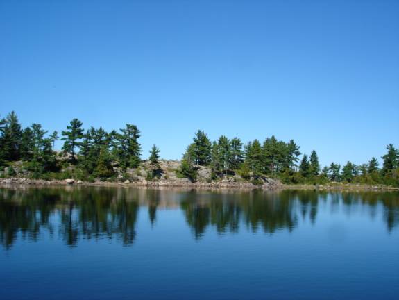
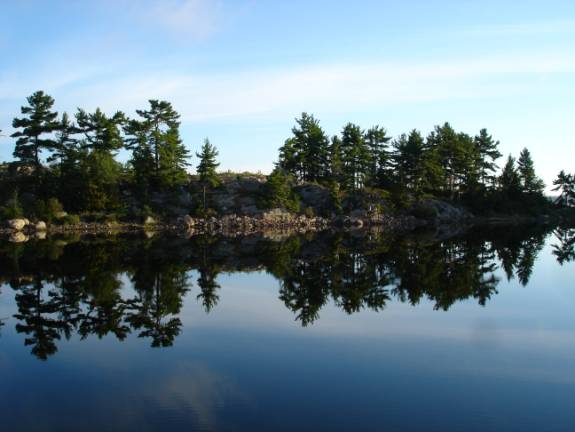
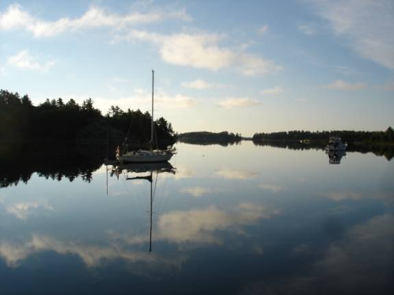
The morning was absolutely gorgeous with its clear skies, 58 degrees,
and perfectly calm. There was not a ripple to be found. The reflections in the clear water were as vivid as the
actual objects. Quite a sight and
quite unusual.
At 8:50 am, we were anchor up and watching closely for deadheads as we
exited the harbor. A lovely
cruise through Whaleback Channel and the Northern Passage took us out into the
open waters of the North Channel.
The winds were forecast to freshen and begin to flow from an
undesirable direction on Tuesday. Our plan to visit Thessalon, Ontario was postponed and we set
our course for Drummond Island, Michigan.
At 3:15 pm, we crossed the international border at N46 06.616 W083
35.695. Onward in the stiffening
winds and spraying waves to round Chippewa Point into False DeTour Channel.
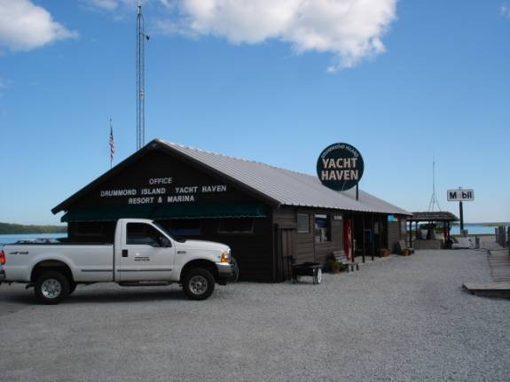
At 5 pm, we were tied up at the Drummond Island Yacht Haven.
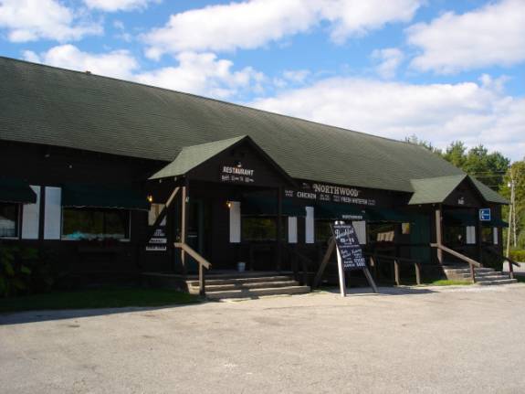
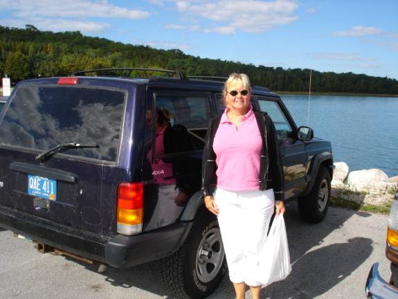
We cleared customs and took advantage of the inexpensive rental car. A small tour of the island and a wonderful dinner of Broasted
Chicken at the Northwoods Restaurant made for a nice end to a long day at sea.
POSITION:
N46 01.507 W083 44.904. 08/22/06 TUESDAY DRUMMOND ISLAND TO HESSEL, LES CHENEAUX ISLANDS
The forecast for this morning has proved to be 100% wrong.
The inclement conditions did not materialize and we had beautiful calm
conditions. We decided to make
good use of the rental car and did some grocery shopping and had breakfast at
a nice little place called the Island Bakery and Restaurant.
They brought out some fresh pies and we bought a blueberry one.
We prepared the boat to leave and headed out.
Our destination was still unclear.
We had decided to get some fuel at DeTour Village.
Drummond Island fuel was $3.369 per gallon and DeTour was $3.249
including a free night of dockage with 150 gallons minimum.
We did put on the 150 gallons, but, we declined the dockage as the
weather was too nice to stop this soon and the forecast warranted that we move
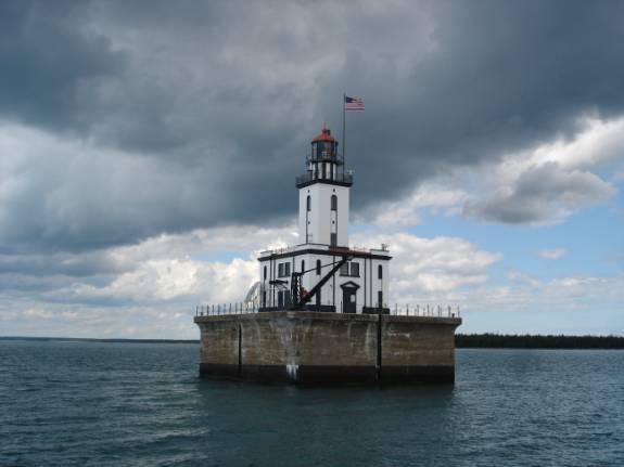
on. From DeTour Passage, we
entered the waters of Lake Huron. DeTour
lighthouse was quite a sight as the dark clouds and windy conditions greeted
us once again in these more open waters.
Our good friend, Bob in Mexico ( a diehard Michigander), highly
recommended that we visit the Les Cheneaux Islands.
His cousin has a cottage there and Bob always enjoyed his visits.
The area lies along the northern part of Lake Huron and on the Upper
Peninsula of Michigan. Per our
guidebooks, we entered at the eastern channel into Government Bay. We passed by Coryell Island waving madly to Bob’s cousin,
Howard, but, alas, there was nobody ashore to wave back. Oh well……
We made our way toward Cedarville where the channel became shallow and
very clogged with weeds. On six
occasions, the props and rudders were so fouled that we could barely make
forward way. The remedy was to back down sharply to back-spin the weeds
off and then proceed forward. We
found out later that many folks are not passing through Cedarville anymore and
that the weedy conditions are starting to affect the economy there. The
scenery through the area made up for any inconvenience.
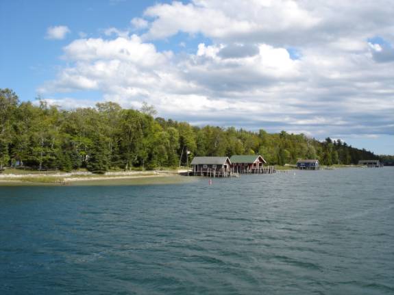
So many lovely cottages and wonderful little boathouses line the
shores.
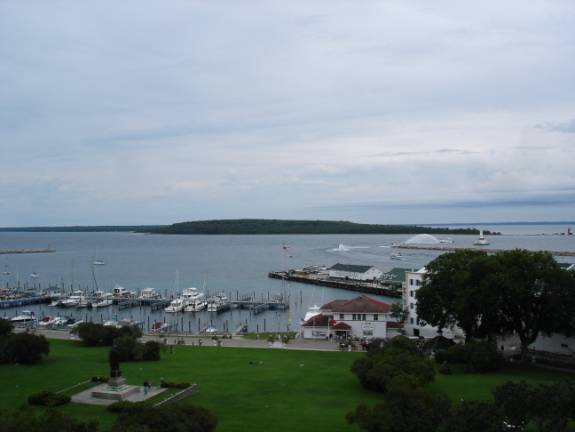
About 5 pm, we secured to the dock at Hessel Marina.
This place is part of the MHR system.
The Michigan Harbor of Refuge system was established many years ago to
provide a safe place for boaters at close enough intervals all along the coast
of Lake Michigan. With affordable
rates and nice facilities, they really help to foster the boating experience. For only $40, we had a nice, comfortable marina to spend the
night.
Our plan to dine at the Hessel Inn was foiled as the owners had closed
at 2 pm for the day. They said in the note that they needed a night off.
Well, OK, we’ll just go up the street to the Islander Bar.
Much to my delight, they serve a Michigan draft beer called “Bell’s
Oberon”. I had enjoyed it last year on a business trip.
If you like beer, I urge you to try several if you ever come across it.
I think it is the best beer I’ve ever had.
It is brewed in Kalamazoo, Michigan.
This makes, at least, two of my favorites that come from Kalamazoo.
As many of you know, Judy is from Kalamazoo.
The burgers were pretty good too.
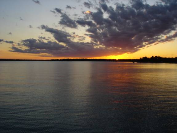
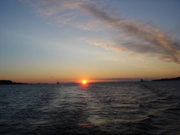
Nice sunset.
POSITION:
HESSEL, MICHIGAN N46
00.134 W084 25.540 08/23/06
WEDNESDAY HESSEL, MI
TO MACKINAC ISLAND, MI
With the help of some neighboring boaters, we cast off the Hessel
Marina docks at 8:10 am. AMARSE exited the Les Cheneaux Islands through the western
channel. The islands name comes
from the French interpretation of the Indian words for “channels”.
Some of the locals also call them “the snows”.
Just two hours later, we were docked at the marina in Mackinac Island.
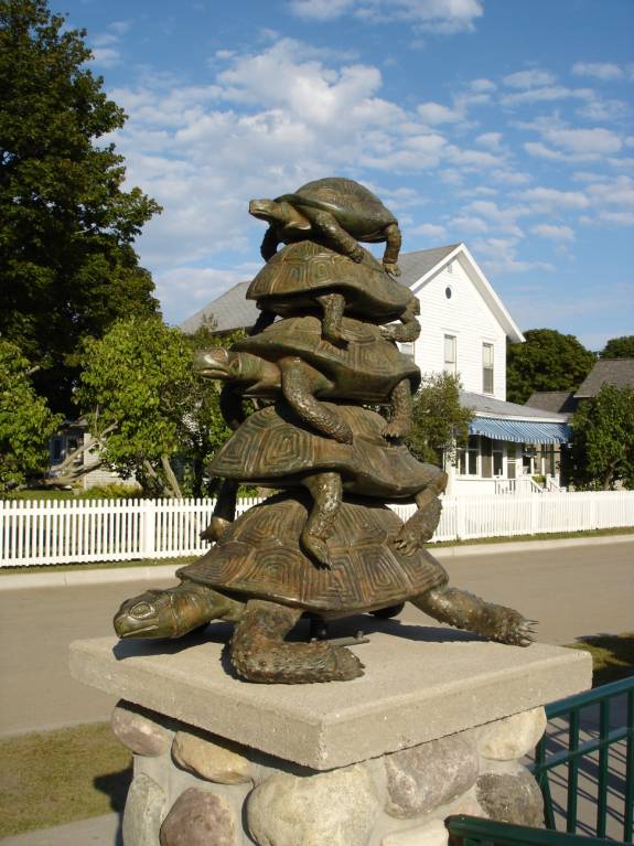
(The word “Mackinac” is really pronounced “Mack-In-Naw”. It comes from the Indian translation for “turtle”.
Many folks had suggested that we not come to this marina.
We, however, have had a great experience here.
Some say that it is better to go to Mackinac City or St. Ignace and
then take a ferry over to the island. Their
reasoning was that the wakes and waves from the arriving and departing ferry
boats make the marina extremely uncomfortable.
Perhaps there has been a change in procedures as we experienced very
little rocking at our inside slip on the western side of the long docks. Tourism seems to be down quite a bit and we had no trouble in
getting a slip. Perhaps the high
fuel prices and slumping economy are having a major impact.
Judy was truly excited about being here on the island.
She has visited several times before, however, not in more than 30
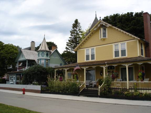
years. Mackinac Island has tried to preserve its Victorian heritage
and historical reference. No
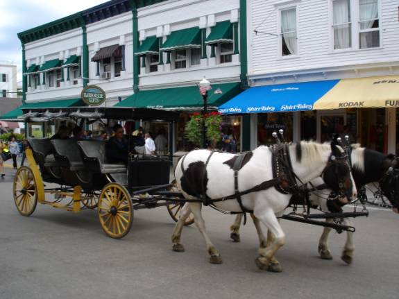
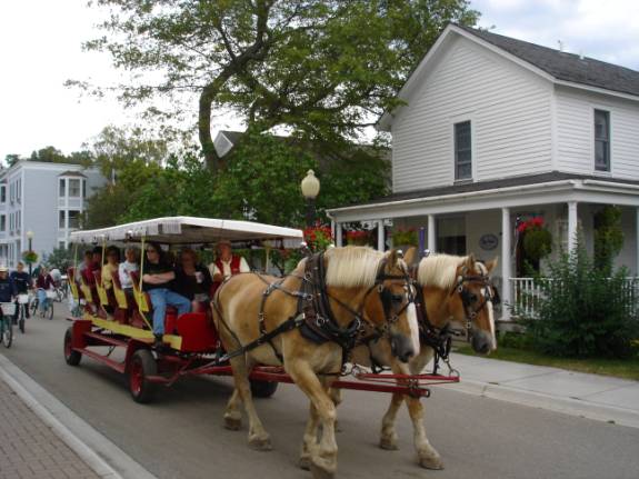
motorized vehicle (other than emergency vehicles) are allowed on the island.
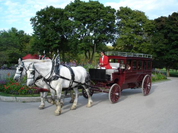
The more than 500 horses, buggies, and various horse-drawn carriages
provide most of the island transportation.
There are literally thousands of bicycles everywhere.
The island boasts a highway upon which no cars are allowed and has no
beginning and no end. The highway
passes around the island for 8 miles.
We decided to take the walking tour of the downtown area and along the
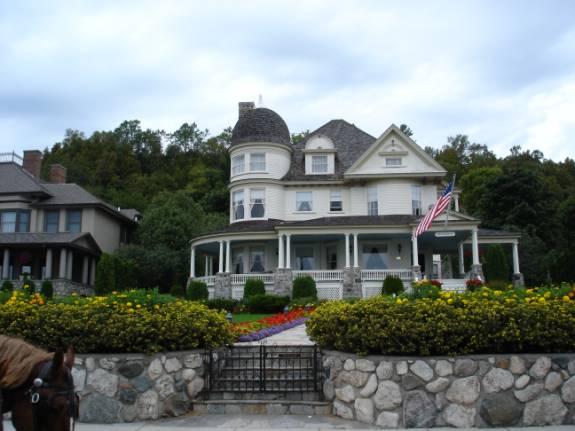
boardwalk. It is very lovely with
the homes of the extremely wealthy lining the main street.
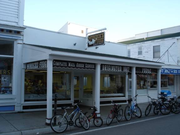
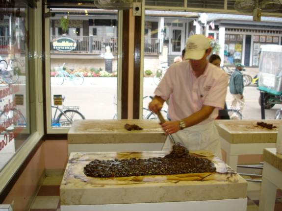
The major industry of the downtown area are the “fudge shops”.
Since 1887, fudge has been a Mackinac favorite and there are over 17
shops specializing in the sweet treats.
Now for the history lesson of the day: Mackinac Island was the second
US National Park. (Do you remember the first US National Park?
Sure you do, it was Yellowstone.)
Around 1907, the island was converted to Michigan’s very first state
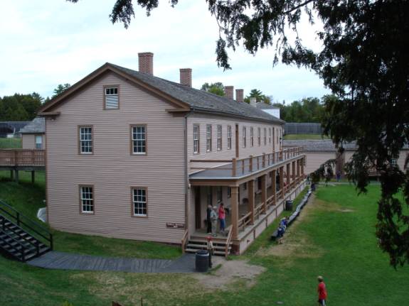
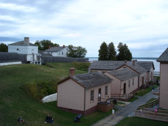
park. Fort Mackinac sits perched
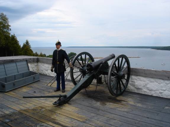
high on the hill facing the harbor. It
was here that the first engagement in the War of 1812 occurred between the
British and US forces. Some 500
to 600 British and Indian sympathizers stealthfully set up a cannon and
prepared to attack the fort. The
warning note to the US commander urging his surrender was the first thing that
young commander had heard about war being declared.
With only 54 men that were unprepared for battle, he surrendered to the
British without bloodshed. Thus,
the War of 1812 was begun here. As
part of the Treaty of Ghent, the island and fort were restored to US control.
The fort was active until the late 1800’s.
With all of this history, Judy was eager to take the tour of the
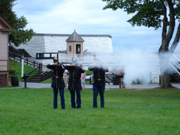
landmark site. We found it very
interesting, well restored, and educational with the numerous displays and
reenactments of cannon blasts, rifle firings, and ranger talks.
I took so many pictures using Judy’s camera that we filled the
storage chip completely.
Back at the boat, we replaced the camera chip with the larger one and
headed out for more “touristy” stuff.
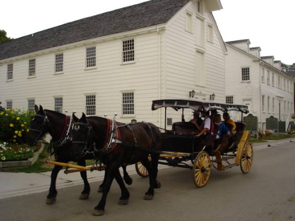
We boarded the double horse-drawn sightseeing tour that passed through
the village streets and historic buildings and homes.
Near the fort, passed the fur trade buildings, the Biddle House, and up
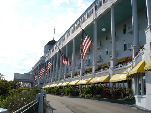
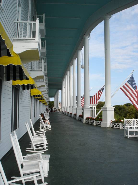
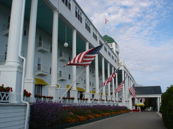
the hill toward the famous “Grand Hotel”.
Who can forget the movie “Somewhere in Time” starring Christopher
Reeve and Jane Seymour?
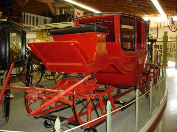
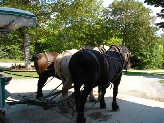
At the carriage museum, we transferred to a different carriage pulled
by a three horse team.
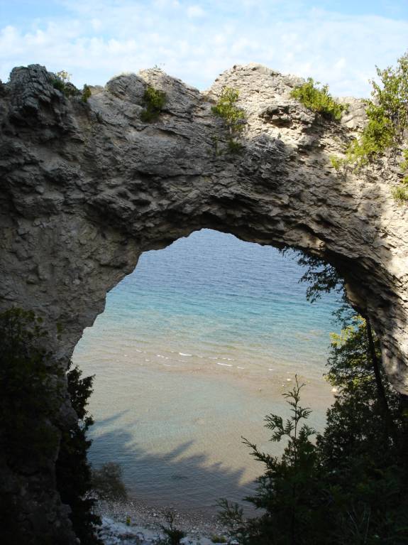
It took a wooded route through the island wilderness to the “Arch”.
This natural wonder is quite unusual for this area.
On the return trip, we got off to try a visit to the “Grand Hotel”.
We toured the hotel stable on the way.
As we approached the entrance to the hotel grounds, the guard informed
us of a $12 per person charge to enter the property.
We declined but did get a few nice photos. We did not meet the stringent dress code anyway.
The guest transportation is in one of these very elegant, horse-drawn
carriages that are gorgeously shiny and stunningly picturesque.
The name “Mackinac” represents “turtles”.
I hope that our friend, Phil Hall, enjoyed this statue during their
visit last year. Linda said she
never even knew that he like turtles so much.
Tonight was the first night of the “Fudge Festival” and we planned
to attend a concert in the park at Windermere Point.
A sign at the park informed us that the concert had been moved to
Horn’s Bar and Restaurant. We
found it crowded but took seats at the bar and enjoyed some more of that great
“Bell’s Oberon” beer. A
booth became available and we enjoyed Chimichanga dinners.
Judy loved the chicken version and I enjoyed the spicy beef one. The music wasn’t really our style so we wandered our weary
bodies back to AMARSE for some much needed rest. POSITION:
N45 50.989 W084 36.944 08/24/06
THURSDAY MACKINAC
ISLAND TO LELAND, MICHIGAN
The alarm was set for 6 am. I
reviewed the weather forecast and formulated a route to the south.
At 6:35 am, we cast off from slip #46 and out of the still sleepy
harbor.
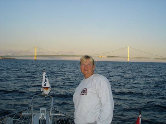
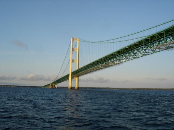
As the sun rose over Lake Huron, it illuminated the famous Mackinac
Bridge that connects the mainland of Michigan with the Upper Peninsula.
Judy seemed to really enjoy the view from the bow and, perhaps, she
enjoyed her many fond memories of years past in her Michigan life.
At 7:23 am, we passed directly under and directly center of the
Mackinac Bridge that spans the Mackinac Straits.
We are now in that vast body of water known as Lake Michigan.
As we proceeded southbound, the winds slowly began to freshen and the
waves were running in the 3 foot range right off the port beam.
This caused the boat to roll back and forth in a rather uncomfortable
manner. The chairs and boarding steps would occasionally go zipping
across the floor. As the
afternoon progressed, the wind and waves moved aft and were more on our stern.
This causes a wallowing motion that is difficult for the autopilot to
control. We would see numerous 4
footers and winds about 20 knots.
We had decided to head for Leland, Michigan since the forecast for the
next several days was for inclement conditions.
This would south us a bit more than Charlevoix.
When we came into the break walled harbor at Leland, the wind was
honking about 25 knots and gusty. Assigned
to slip # 18, this wind was at right angles to the slip and very strong. The young dockhands were not very adept at line handling and
needed lots of verbal guidance. AMARSE
has a lot of “windage” or area for the wind to blow against.
This presents a challenge to this kind of docking condition.
We placed extra fenders and lines on in preparation for the worsening
weather forecasted to approach.
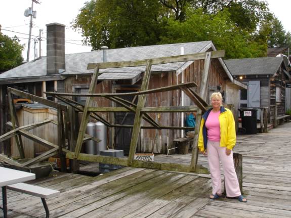
We walked to the little area called “Fishtown” located near the
docks. It is a quaint grouping of
shops and boutiques made up of old fishing shanties and ice huts.
The area still hosts the fleet of charter fishing boats.
While we were there, one such party brought in an impressive catch that
was hung proudly for their trophy photos.
We did some grocery shopping and decided that we would enjoy our dinner
of “Frito Pie” aboard the boat tonight.
During the night, the rains began and continued through most of the
night and into the morning. POSITION:
N45 01.511 W085 45.725 ATTENTION:
SPECIAL NOTE:
Well, my friends, we are back in the good ole USA.
My Verizon AirCard that operates my computer internet still operates
sporadically. The coverage areas
are not as good as we had hoped. We
will be sending out updates when we can.
Judy has Cingular Wireless cell phone service again.
It seems to work even better than the Verizon Wireless in these parts
of Michigan. Judy can be reached
at 361-550-5353
and Fred can be reached at 210-296-4933.
We can be reached at either number.
Please call us if you like, we’d really like to hear from you. "AMARSE".
is pronounced "AM-ARE-SAY". Our website is: www.amarse.net
. Check
it out while we will attempt to keep you informed via email
We would like to hear more about what is happening in your lives.
Let us know as we very interested in what’s going on with our friends
and family. Please DO email us with your thoughts and comments and ideas
too. Thanks Lot
of Love, Fred
Reed and Judy Law AMARSE MT40
|
|
Fred H. Reed |
www.amarse.net © 2006 2007 2008 2009 2010 2011 |